
|
Arborfield
|
|
Properties
Related sites:
Reading Road and Walden Avenue Arborfield Cross and School Road Swallowfield Road, White's and Bartlett's Farms
Modern aerial photo of Ducks Nest and Targetts Farms, courtesy of Multimap
|
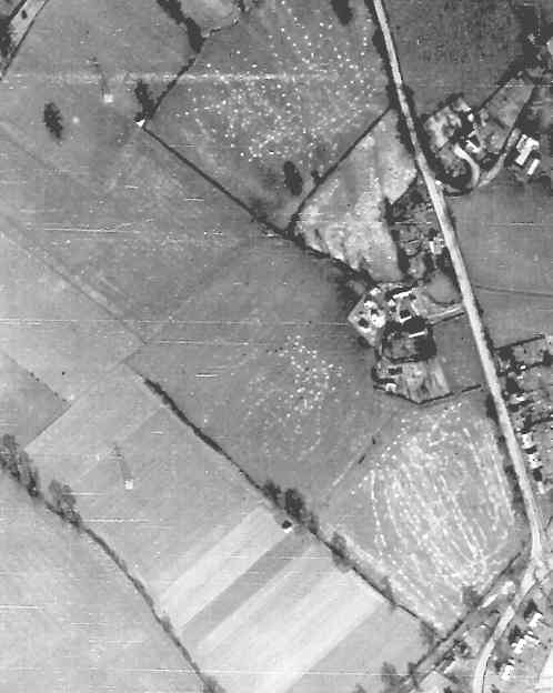
Detail from RAF aerial photo of part of the parish of Arborfield, dated 10th March 1946, ref. 3040, reproduced by permission of the National Monuments Record, English Heritage.
This is a view of Duck's Nest Farm. The Army used the land for manoeuvres during WWII and for many years afterwards, and several fields bear the scars. The duck-pond can be seen alongside Reading Road, in front of Duck's Nest Farmhouse. To the north are Duck's Nest Cottages; the top three were replaced by detached houses about 20 years after this photo was taken. On the east side of Reading Road are the Council Houses on Eversley Road, but since 1969 this section is a cul-de-sac called Rickman Close. Back to Aerial Photos main page
|
|||
|
Any Feedback or comments on this website? Please e-mail the webmaster |