
|
Arborfield
|
|
Properties
Related sites:
Reading Road and Walden Avenue Arborfield Cross and School Road Duck's Nest Farm and Eversley Road
|
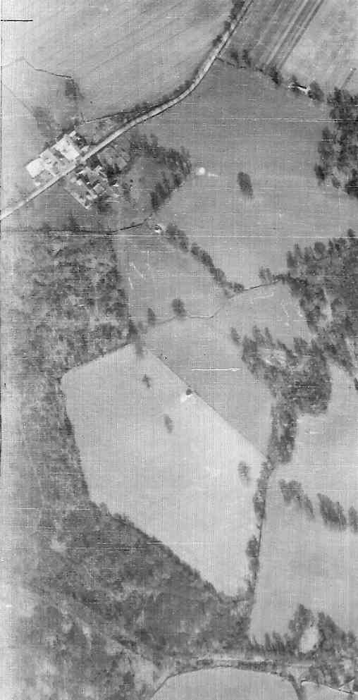
Detail from RAF aerial photo of part of the parish of Arborfield, dated 10th March 1946, ref. 3040, reproduced by permission of the National Monuments Record, English Heritage. It shows the two farms, White's on the north side of the road and Bartlett's on the south side. To the south of Bartlett's Farm is a stretch of woodland which has since largely been cleared.
At the bottom of the picture is Wokingham Lane, which goes from Bound Oak in the west to the 'Bramshill Hunt' public house off the picture to the right. However, since the Garrison By-Pass was completed in 1969, the section of Wokingham Lane to the east of the A327 has effectively become part of Baird Road. Back to Aerial Photos main page
|
|||
|
Any Feedback or comments on this website? Please e-mail the webmaster |