
|
Arborfield
|
|
Properties
Related sites:
Reading Road and Walden Avenue Arborfield Cross and School Road Swallowfield Road, White's and Bartlett's Farms Duck's Nest Farm and Eversley Road Modern aerial photo of Arborfield Court, courtesy of Multimap
|
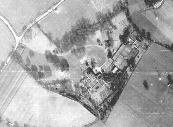
Detail from RAF aerial photo of part of the parish of Arborfield, dated 10th March 1946, ref. 3040, reproduced by permission of the National Monuments Record, English Heritage.
This is a view of Arborfield Court, whose land stretched to Duck's Nest Farm. The Army used the land for manoeuvres, and it looks as if the land enclosed by the arc of the main drive has been damaged ay Army activity. At one stage, the War Dept. planned to buy Arborfield Court, but in the event it was sold at auction and split into flats in the late 1940's. The Army continued to use Duck's Nest Farm, to the right of this close-up, until the late 1950's for light tactical training. Back to Aerial Photos main page
|
|||
|
Any Feedback or comments on this website? Please e-mail the webmaster |