
|
Arborfield
|
|
Properties
Related sites:
1944 Close-ups:
Modern
The effect of the Motorways on the growth of Arborfield and its neighbours
|
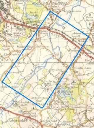
Compare it against the old Ordnance Survey map shown on the right. You should now be able to see:
Winnersh, the A329 and Loddon Bridge at the top, along with the
railway line (by the way, Earley station was known at one time as
'Little
Hungerford'); Arborfield Cross is off the picture to the bottom right.
Picture No. 5045 was part of a series of overlapping photos, and No. 5046 (not available here) shows Winnersh Cross-Roads in great detail. Back to Arborfield Hall during WWII
|
|||
 The USAAF aerial photo of Carter's Hill
and Winnersh shown below, dated 8th March 1944, ref. 5045, is reproduced by permission of
National
Monuments Record, English Heritage.
The USAAF aerial photo of Carter's Hill
and Winnersh shown below, dated 8th March 1944, ref. 5045, is reproduced by permission of
National
Monuments Record, English Heritage. 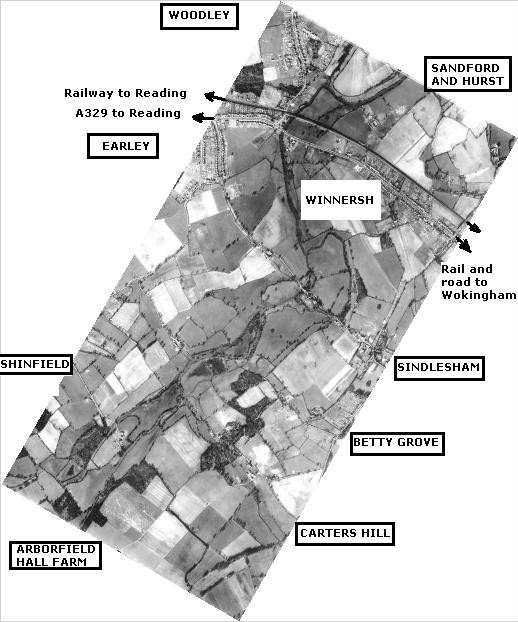
|
Any Feedback or comments on this website? Please e-mail the webmaster |