
|
Arborfield
|
|
Properties
Related sites:
Reading Road, Church Lane, Greensward Lane and Walden Avenue Arborfield Road from Shinfield to Loddon Bridge Arborfield Hall and the River Loddon Arborfield Hall Farm towards Church Lane The former 'Starfish' decoy site Shinfield from Cutbush Lane to the Loddon
Modern aerial photo of Reading Road and the replacement Arborfield Bridge, courtesy of Multimap |
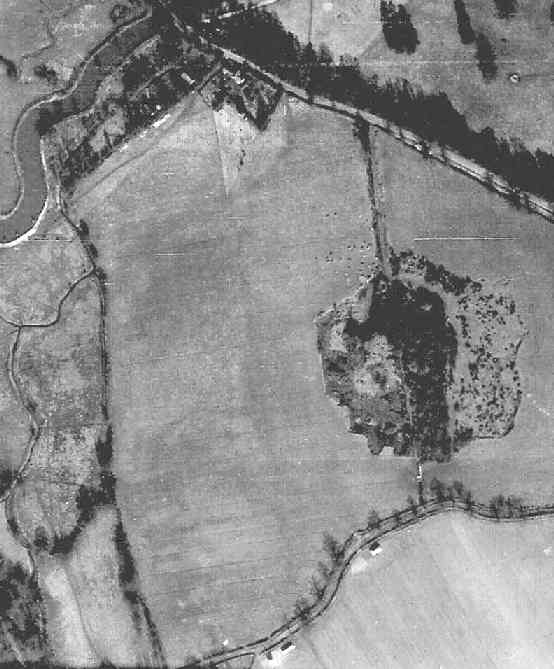
RAF aerial photo of Lower Arborfield and Shinfield, dated 10th March 1946, ref. 4042, reproduced by permission of the National Monuments Record, English Heritage.
This view is of Reading Road from Arborfield Bridge over the Loddon, eastwards towards Arborfield. The curious-looking patch towards the bottom is a copse which has thickened-out in the intervening years, and now reaches down to Milking-Barn Lane. At the bottom of the picture is the Gamekeeper's Cottage, just to the west of the north-south public footpath. There used to be a right of way along Milking-Barn Lane to the south-west (off the photo), but it petered-out after a short distance. The Right-of-Way was removed, but as compensation, Arborfield and Newland Parish Council gained a piece of land known as Pound Copse. Bridge House is towards the top of this view. Back to Aerial Photos main page
|
|||
|
Any Feedback or comments on this website? Please e-mail the webmaster |