
|
Arborfield
|
|
Properties
Related sites:
Reading Road further west to the River Loddon Arborfield Road from Shinfield to Loddon Bridge Arborfield Hall and the River Loddon Arborfield Hall Farm towards Church Lane The former 'Starfish' decoy site Shinfield from Cutbush Lane to the Loddon
Modern aerial photo of Walden Avenue and Reading Roads, courtesy of Multimap |
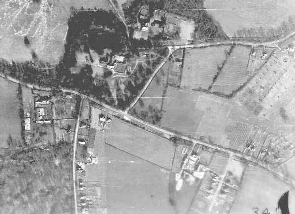
RAF aerial photo of Lower Arborfield and Shinfield, dated 10th March 1946, ref. 4042, reproduced by permission of the National Monuments Record, English Heritage.
Arborfield Grange is at the centre of this view; it had been requisitioned during WWII, and there appear to be extra roadways to cater for wartime use. To its left, the ground has been heavily disturbed by military vehicle movements. Above the Grange is the old Arborfield Rectory on Church Lane - but the lane's alignment in this picture seems to be different from what it is now. Further to the east on Church Lane is a curious arrangement of dots and rectangles. What did they represent? To the south of Reading Road are New Farm, then Greensward Lane, the Cross Lanes Farm and finally the partially-complete Walden Avenue. Back to Aerial Photos main page
|
|||
|
Any Feedback or comments on this website? Please e-mail the webmaster |