Arborfield
Local History Society

 Auctions - Arborfield Grange, 1914, Map

Front Page

Map

Page 3

Page 4

Page 5

Page 6

Page 7

Page 8

Page 9


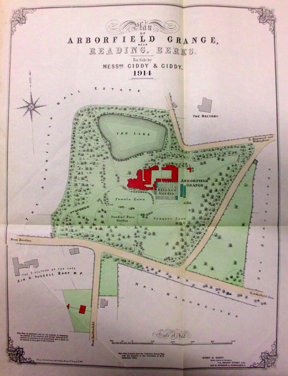
A copy of the Auction Sale document of Arborfield Grange dating from July 7th 1914 can be
seen at Reading Local Studies Library along with those for 1887 and 1921. The main pages
are shown here by permission. The map is based on the Ordnance Survey 25 inch-to-the-mile
map, with the land covered by the Grange in green:


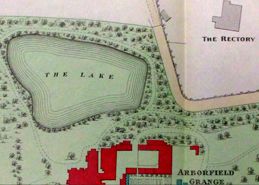
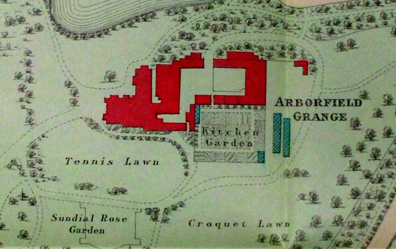
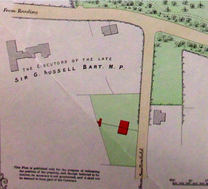
Here are some close-ups of the main features on the map:

  • North and east, including Church Lane and St. Bartholomew's Rectory:

North and east, including Church Lane and Rectory


  • Centre, showing the main buildings and grounds:

Main grounds and building


  • South and West, showing Reading Road and the cottages in Greensward Lane, with the old school opposite:

South and west, showing Greensward Lane cottages

Back to 1914 Auction front page

Back to Auctions Page             


Any Feedback or comments on this website?  Please e-mail the webmaster