
|
Arborfield
|
|
Churches
Related sites:
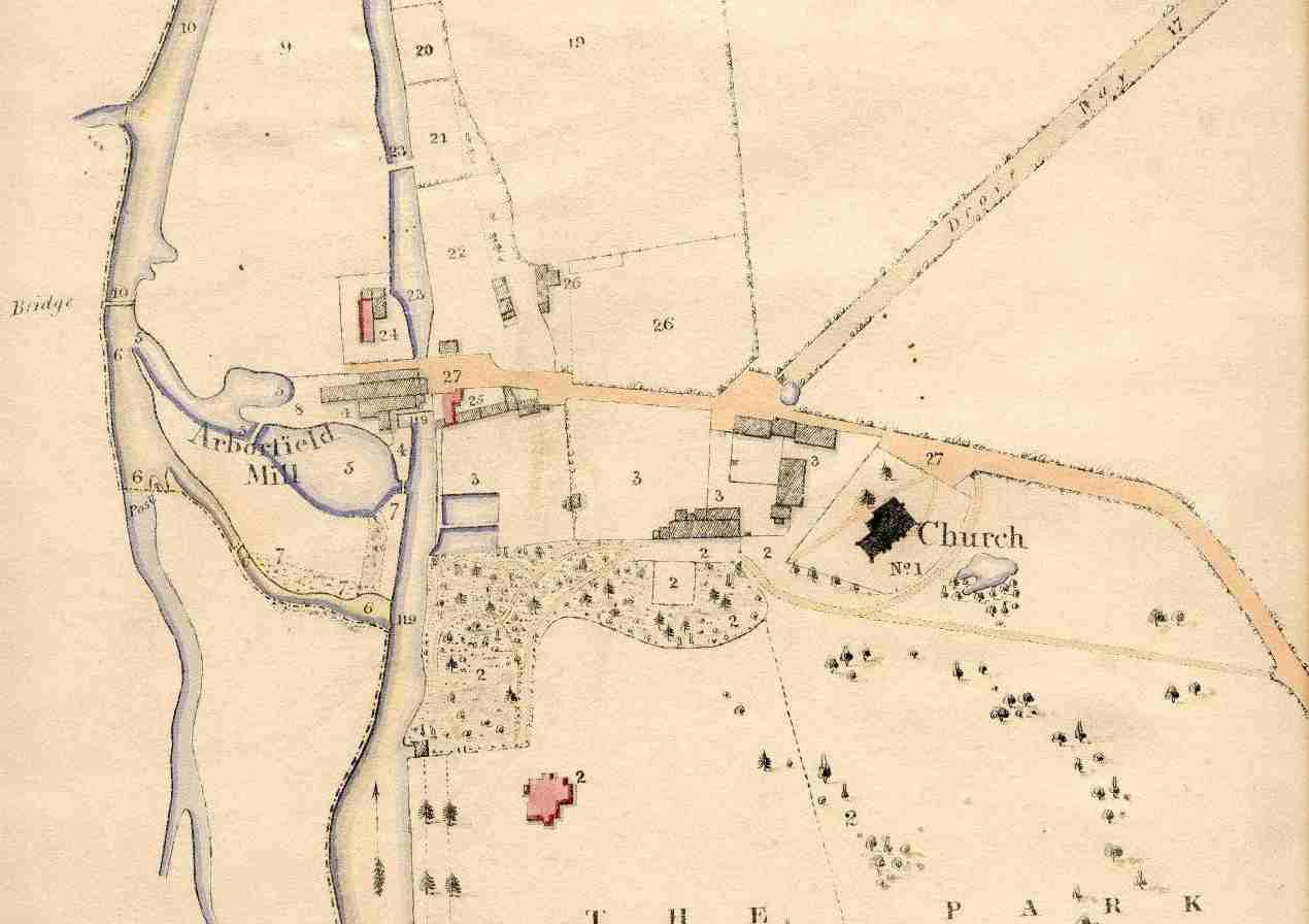
The Arborfield (Paper) Mill complex has shrunk to just the ground floor of the Mill building, now occupied by Thames Water. There is now a more major track leading to the bridge over the Loddon, marked '10' on the map. Hall Farmhouse hadn't been built by this time. The floor-plan of the Church is not far different now, but the pattern of footpaths was changed when the new Church replaced it. The floor-plan of Arborfield Hall was much changed when the building was replaced in the mid-1800's. The later Hall building was demolished by the 1960's and replaced by the house named 'Aberleigh', though the outline of the Hall footings are still visible, along with steps down to the Loddon.
|
This view shows what is now Arborfield Hall Farm from the Old
Church to the River Loddon.
|
||
|
Any Feedback or comments on this website? Please e-mail the webmaster |