
|
Arborfield
|
|
Properties
Related sites:
School Road, Link Way, Melrose Gardens, Eversley Road Duck's Nest and Targett's Farms, Eversley Road Eversley Road near the Brickworks |
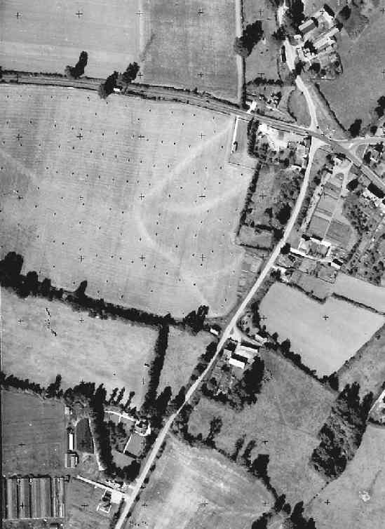
This is part of an Ordnance Survey aerial photo of Arborfield Cross, Arborfield Court, Ducks Nest Farm and part of Arborfield Garrison, dated 30th August 1961, ref. OS/61034 frame 72, supplied by the National Monuments Record, English Heritage, now out of copyright, and reproduced under licence from Ordnance Survey. Note the '+' marks, used when creating a map from the photo.
This view captures the future site of Arborfield Park (dotted with what appear to be sheaves), Swallowfield Road down to the then-wholesale nursery, the five-way cross-roads, the 'Bull' public house, Pond Cottages and Newland Farm. Apart from the demolition of the Parish Cottages opposite the 'Bull' and the improvement to Swallowfield Road, and of course the improvements to the A327, this view is not that far different from those in 1946.
Back to Aerial Photos main page
|
||
|
Any Feedback or comments on this website? Please e-mail the webmaster |