
|
Arborfield
|
|
Related sites:
Summary |
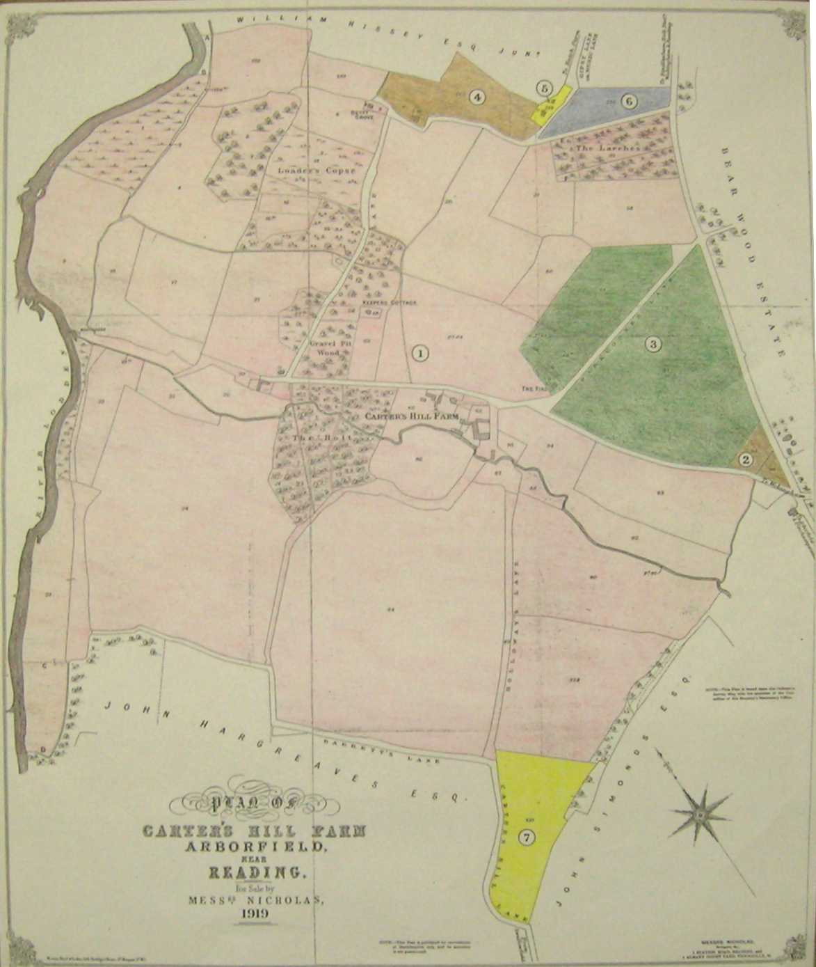
This map shows all of the Lots in the 1919 Auction. Lots 4 and 5, along with the meadow from Lot 1 adjacent to the cottages at Betty Grove, were later sold off to Berkshire County Council for the Small Holdings Scheme. The M4 cut through part of this land, and it is believed that the Boat House on the River Loddon that was let to John Simonds made way for the motorway bridge. It also seems that the Mole Brook and River Loddon were diverted to accommodate the embankments of the road. Holloways Lane was not adopted as a right of way, though the rest of the lanes are accessible. Note the 'Gravel Pit Wood' at the corner of Julkes Lane and Loader's Lane. This would have been used when the Parish had a duty to maintain the roads that passed through the area. By a law passed in 1555, a Surveyor had to be appointed by the Parish, and the parishioners had to provide four (later six) days of labour to maintain the road network. For some fascinating detail on the subject of local road maintenance over many centuries, read 'The Great Road to Bath', by Daphne Phillips (Countryside Books, 1983), available at Local Studies Libraries.
|
||
|
Any Feedback or comments on this website? Please e-mail the webmaster |